
The official site plan and interactive map serve different purposes. The plan shows burial fields and the path structure; the map provides filters, coordinates and a numbered text list.
Open the official site plan
Open the official site plan image
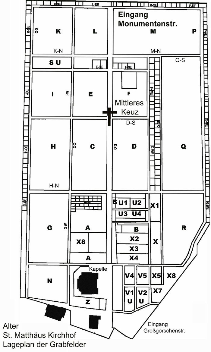
The operator’s portrait-format plan has been reviewed in full. It shows the fields, principal paths and three historically labelled entrances. It is an orientation diagram rather than a georeferenced overlay, and no coordinates were derived from it.
Interactive orientation
The map includes two Grossgoerschenstrasse visitor entrances, the chapel, a toilet, history board, café and flower shop, three memorials and two historic burial structures. Filters and text list share the same numbering.
Deliberate limits
- The Monumentenstrasse entrance appears on the official plan but is tagged
access=noin OpenStreetMap; it is not shown as a visitor entrance. - The reviewed map inventory contains no specific water point inside the grounds.
- The Garden of the Stillborn Children and other known places without precise open coordinates receive no estimated marker.
- The 20 July memorial is a place of remembrance, not a surviving individual grave.
To find a particular grave, you need a sound location reference. The site plan is not a name index; see grave search for a practical method.